When I voiced my excitement for wanting to head up into the Alps and see the Swiss Cows with bells, I had this image in my head, of a leisurely ride up the mountain in one of those red cog wheel trains, hanging out the window snapping away with my camera as we rolled along the mountainside. Maybe even one of the hanging gondolas that whisk you up the mountain side, as if you were at a fancy ski resort.
What I was not necessarily picturing was a 7.5-mile hike, with a 4,500-foot elevation gain, in 95F heat.
When we first discussed taking a day trip to see one of the famous peaks in the Alps, we talked about going to see Jungfrau, the highest peak in Europe at just over 11,300 feet above sea level and well known for the glacier that you can hike across at the top. This was admittedly a bit far for a day trip from Zurich though, so we started to look at peaks that were a bit closer. Being the Alps, there are plenty to choose from and almost all will give you the same experience of the red cog wheel train, views for days and of course my favorite, the Swiss Cows with their bells clanking away on the mountainside.
We looked into and decided on Mt Pilatus instead, as it was much closer and still offered the full Swiss Alps experience I was looking for. We decided the second full day in Switzerland would be the best to visit this, as the Tour de France was occurring our third day there and the fourth we were heading back home to Germany, via a stop over at Schloss Neuschwanstein, the large castle in the black forest that Disney modeled Cinderella’s castle after.
I was all set. I had my camera gear cleaned and ready and my new (to me anyway) super-duper-wide-angle lens that I had bought just for this trip. So, there we are on day one hanging out in the hotel, and Sven casually says, “So, uh, I think I have a better plan for us for this day in the Alps. I think we are going to hike up instead. What do you think?” My response “(crickets)”. After I let it sink in for a bit, I finally responded with, “We are going to what? Hike? Up the Swiss Alps? Have you lost your mind?”
Keep in mind here, I am still picturing Jungfrau and Pilatus, which are both very tall, very steep, and far too advanced for my then very out of shape self to hike up in a day…or at all. He brought up the website for Mt Rigi though, and assured me that it wasn’t so bad…then immediately bribed me with the promise of getting up close and personal with those Swiss Cows with bells that I was so anxious to see. I quickly agreed.
It was official, I was going for my first legitimate hike. Ever. Since this was a hike up a mostly remote mountain side and not a stroll through the city, we decided it was best that we carry a picnic up with us in our backpacks, so we could stop somewhere along the way to eat.
We took a trip to Lidl, the local food store, and stocked up on items that sort of resembled lunch but didn’t need to be refrigerated. We grabbed croissants, apples, nuts and those small rounds of cheese that come in their own casing, as well as multiple large bottles of water for each of us, then headed back to the hotel for an early night’s sleep.
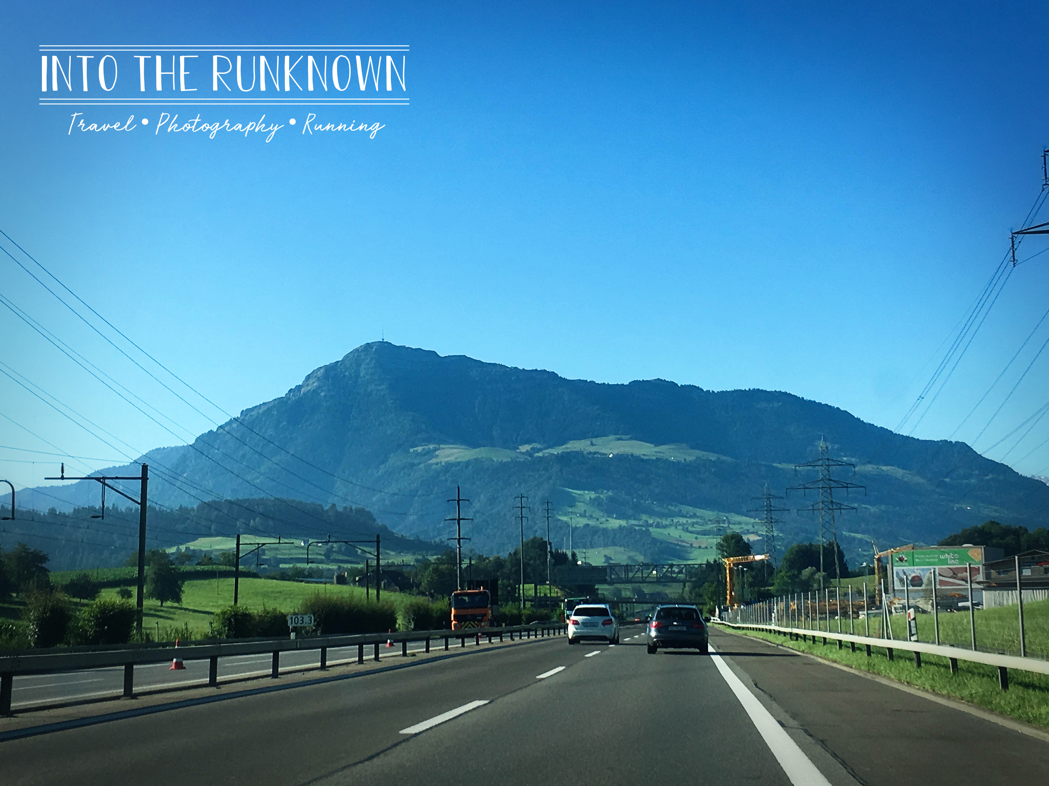
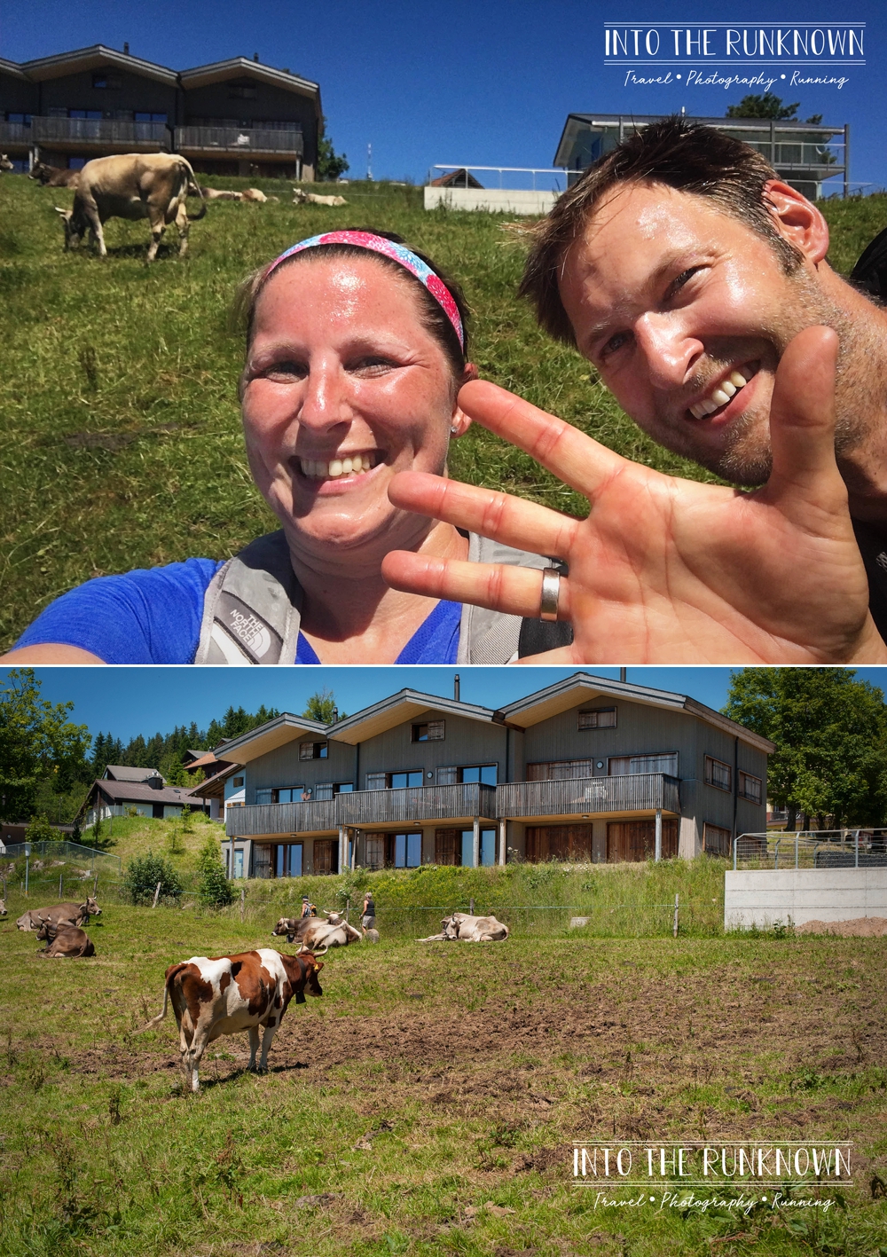
Because this was going to be a full day adventure and the mountain was about an hour away, we had to be out the door by 7am latest. The majority of the drive that morning was on a highway that runs between Zurich and Lucerne, with a direct view of Mt Rigi for more than half of the drive. This of course gave me a lot of time to think about what I had gotten myself into, as the mountain appeared to grow in height the closer we got!
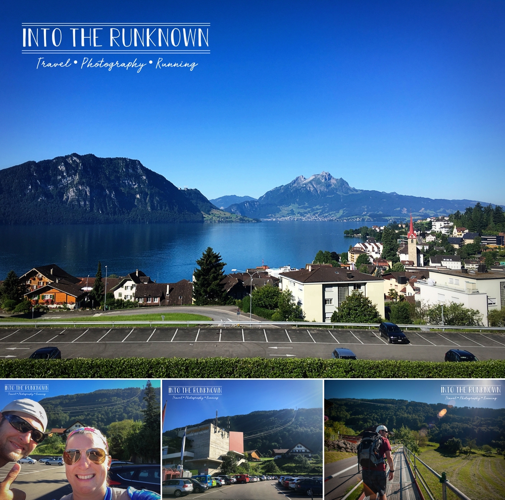
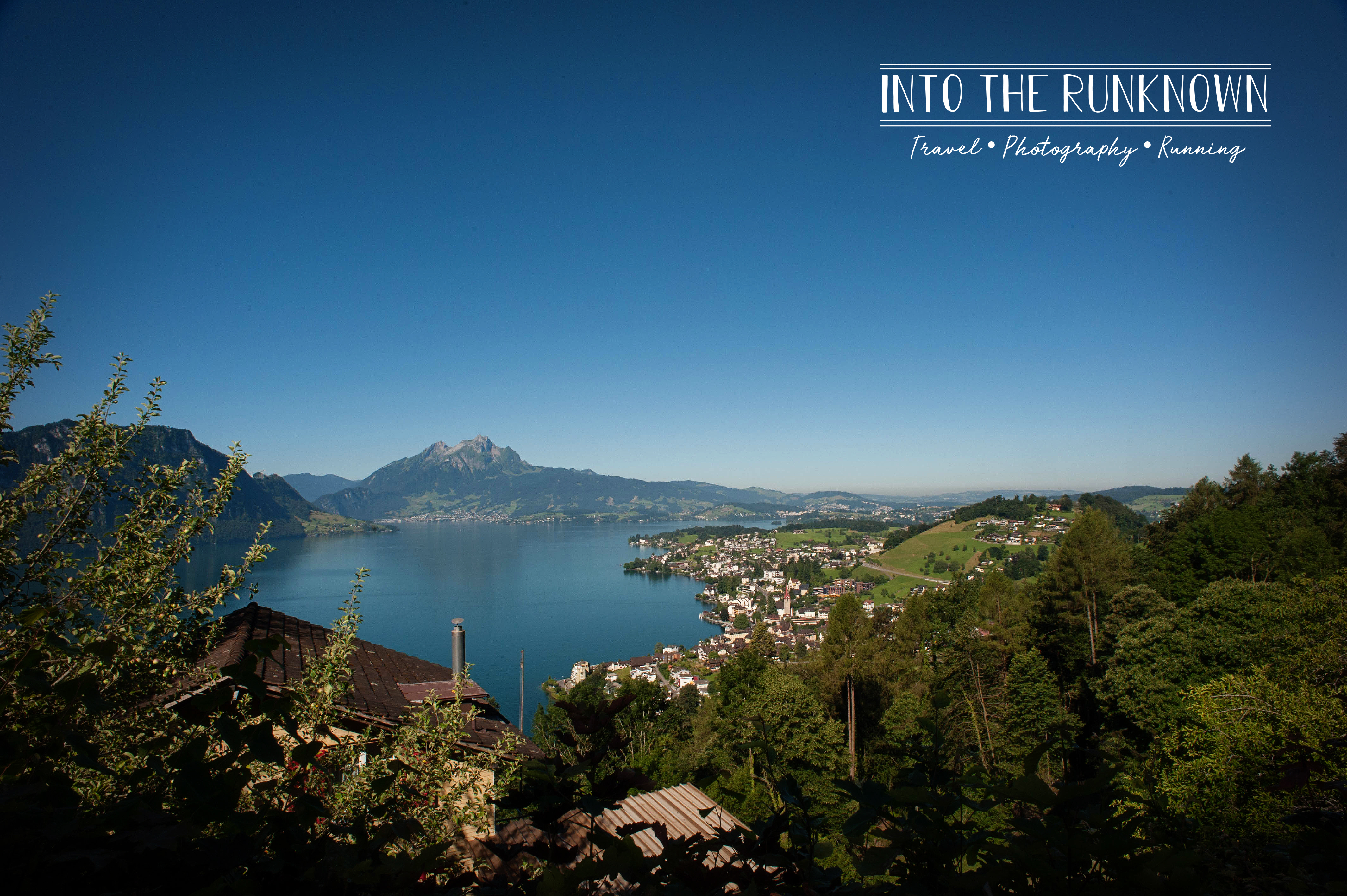
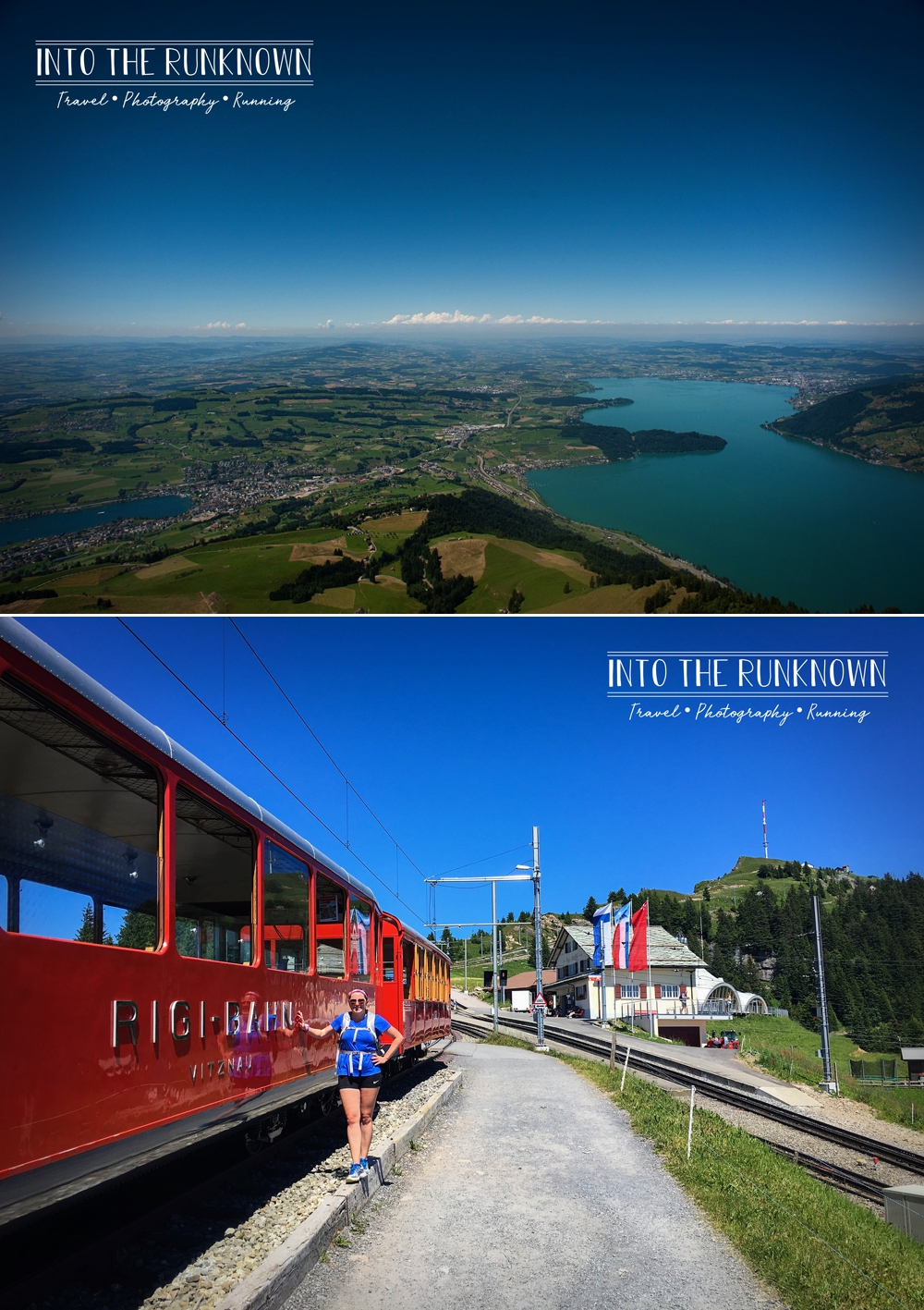
We chose to start our adventure in a little village called Weggis, Switzerland, which sits on the north side of Lake Lucerne and is 1,427 feet above sea level, an important detail as we were about to hike to the top of it. Here you will find a parking lot and small Welcome Center for Mt. Rigi, where you can buy tickets for the Aerial Cable Car and Cog Wheel Train, the way most normal people travel up and down the mountain. A one-way ticket, such as the one we purchased, will run you roughly 45CHF(Swiss Francs), slightly more if you plan to take the Cable Car and Train both ways.
After a quick potty stop, without standing on the toilet seat as the signs in the rest room kindly pointed out was a no-no, and a quick “before” selfie in the parking lot, we made our way around the side of the building and onto a long metal walkway that runs parallel to the road similar to a sidewalk. I think its only purpose was to prevent hikers from being run over on the narrow roadway next to it.
The elevation increased much more significantly then I expected it would. After only a few minutes of hiking, I turned back to find that we were already quite a bit higher then the lake and parking lot area where we started.
Following the bright yellow signs, we made our way up a steep trail in the woods and came out at a clearing with a few houses and a set of 75 or more steps that were dug into the hillside between a couple of houses.
It was here on these stairs, just over a mile into the hike, that I already knew I was in big trouble for the rest of the day.
Despite only being 10am, the temperatures were already a bit toasty, hovering in the high 80F range, with full sun beating down on us. That set of stairs, marked as an easy hike on the trail map by the way, were brutal. I was already sweating profusely and now breathing like I just ran a sub 4-minute mile, which for all of you non-runners is faster than the current women’s world record.
I slowly made my way to the top, laughing the entire way at how out of shape I was, and then of course posed for a photo at the top as if I had just scaled Mount Everest. We also stopped for some photos of the lake and selfie number two, as this was around the one-mile mark. Our plan was to stop for a selfie every mile so that we could one prove we hiked the whole thing and two make a hilarious collage depicting our various states of exhaustion at the end.
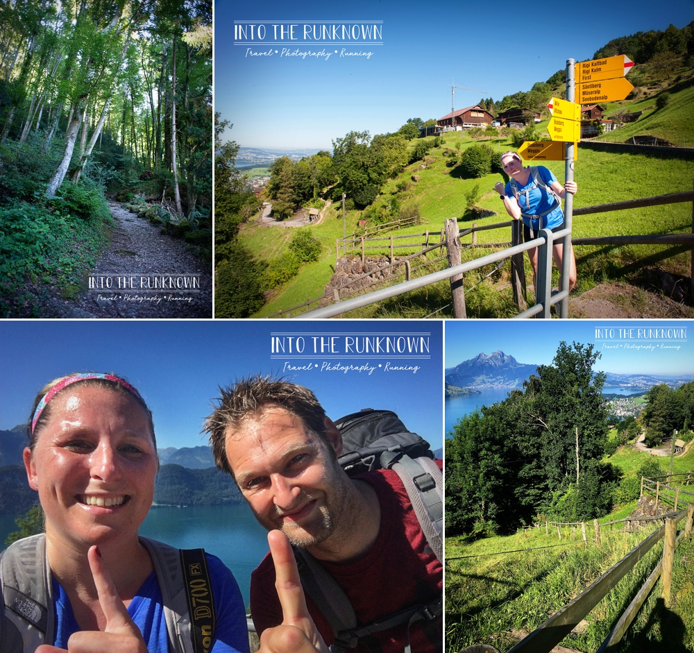
After our mini photo session was over, we continued on along the dirt path that was now sandwiched between a set of wood railings, likely to keep us from tumbling down the one side and to prevent people from wandering up into the private property above.
While the trails are for public use, you are technically hiking through private property the entire way. Some areas are so remote you don’t see any buildings nearby, while other times you are so close to homes you could reach in the window and grab a snack.
The end of this particular stretch of trail required a route decision, as there was now a fork in the road. Unlike Robert Frost however, we chose the path most traveled, which just happened to be called the Mark Twain Trail, named after the famous author spent time hiking there in the mid-1800’s.
The path least traveled required climbing up a ladder on the side of a cliff according to the map, and that seemed a bit more extreme of a hike then we were looking for that day. Having looked up images of this ladder after the fact, I am more then confident we made the right choice. Plus, we ended up seeing a number of exciting things along the route we took.
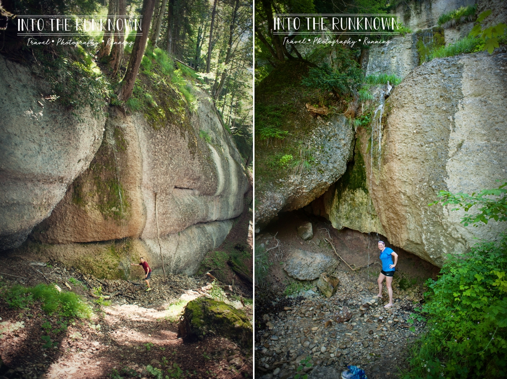
For example, mile two brought us the Kapelle (Chapel) Heilig Kreuz, a small one-room chapel that is tucked precariously in the trees. So tucked in fact, the only way to maneuver around it was a two-foot-wide path between it and the edge of the steep downhill slope off to the side. According to the sign it was built in 1686, so this little chapel on the side of Mount Rigi has been around almost 100 years longer then the United States has been a country. Pretty cool if you ask me!
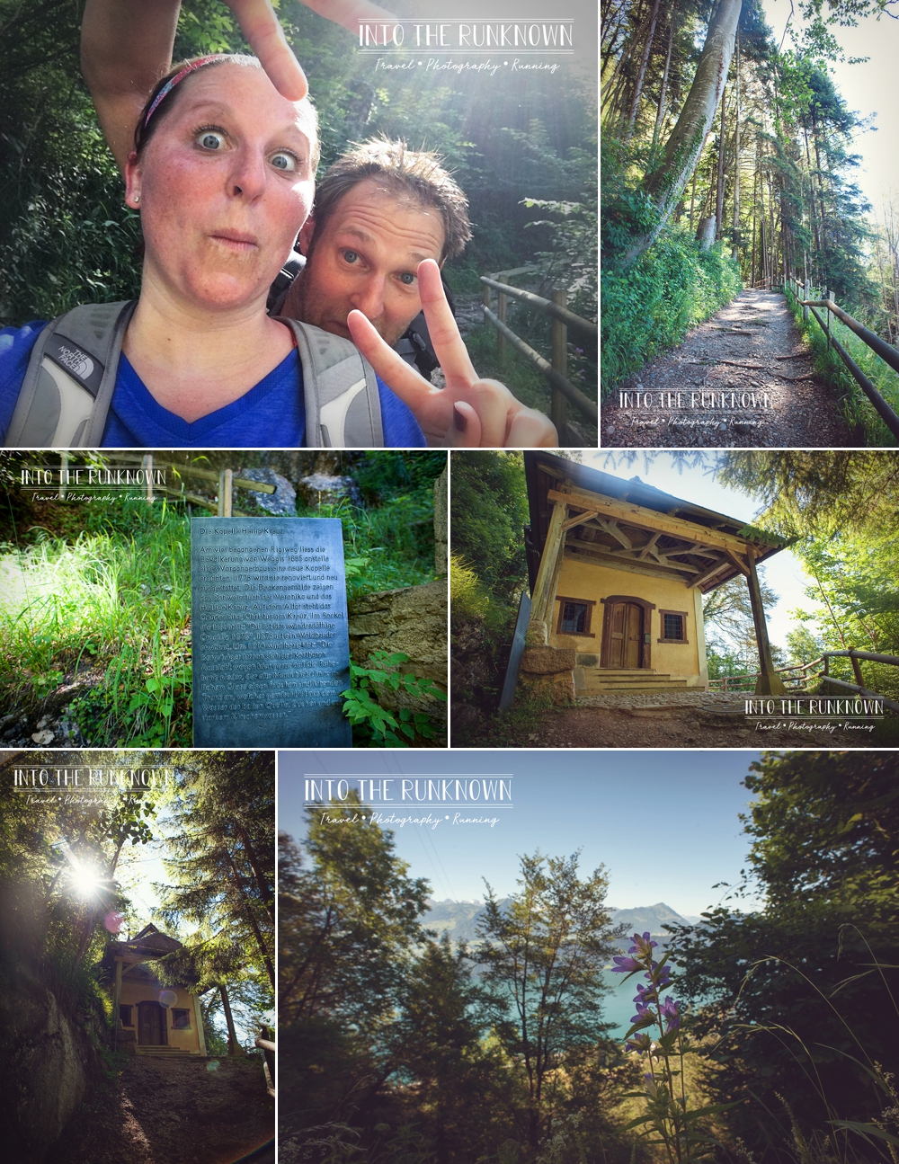
Another exciting find not far from the chapel, was a long shaded trail in the woods with numerous small waterfalls of ice cold spring water flowing down from the mountain above. We took turns standing under them to cool off a bit from the intense heat. This trail also had a number of mysterious doorways, setback inside short tunnels, built into the hillside. I don’t know their official reason for existing, so I am sticking with my guess of gnome homes! It’s only logical!
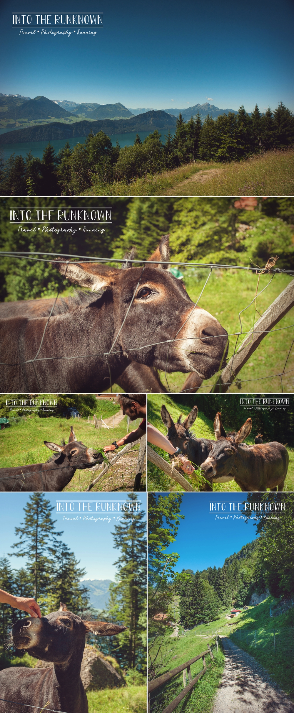
And last but not least, a farm with donkeys! As mentioned previously, many parts of the trail intersect with and become part of people’s private land. This was one of those times! In a fenced field right next to the trail we found a couple of donkeys down a little hill grazing on grass. Jokingly, I started making the same clicky noise with the side of my mouth that you would to a horse, not expecting any sort of reaction. Turns out, donkeys also react to this noise and came running up the hill to see us! We plucked a few handfuls of grass from along the fence and offered it to them, which they happily took and munched on. After a few nose scratches for the donkeys and me for my healing sunburn, we continued on our way, as I had a date with some cows to get to!
Mile three brought another selfie, and the hilarious realization that Americans and Europeans hold up three fingers in completely different ways! It also thankfully brought a lengthy break to sit and eat lunch in the garden at the Felsentor Retreat Center. Built in 1869, it pre-dates the Vitznau-Rigicogwheel train and was originally used as a tavern and inn for tourists and guides making the trek up to the peak. It is now used for Buddhist retreats and meditation workshops, but the grounds are open to hikers to relax in as they pass through. At this point we are now 3,707 feet above sea level and have hiked 2,280 feet of elevation in a span of roughly three miles. Any questions yet as to why I was on the struggle bus?
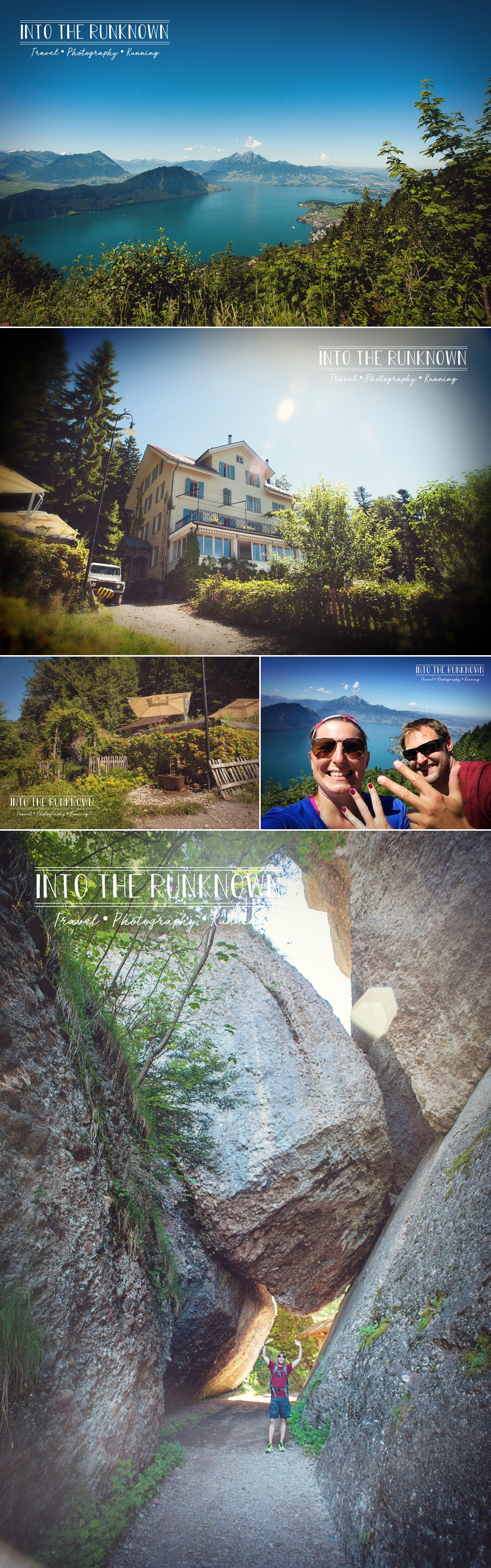
To rejoin the trail, we walked through a large boulder formation that looked like a mini tectonic plate science experiment by giants gone wrong. It showed no signs of moving, but was still a little unnerving to walk through.
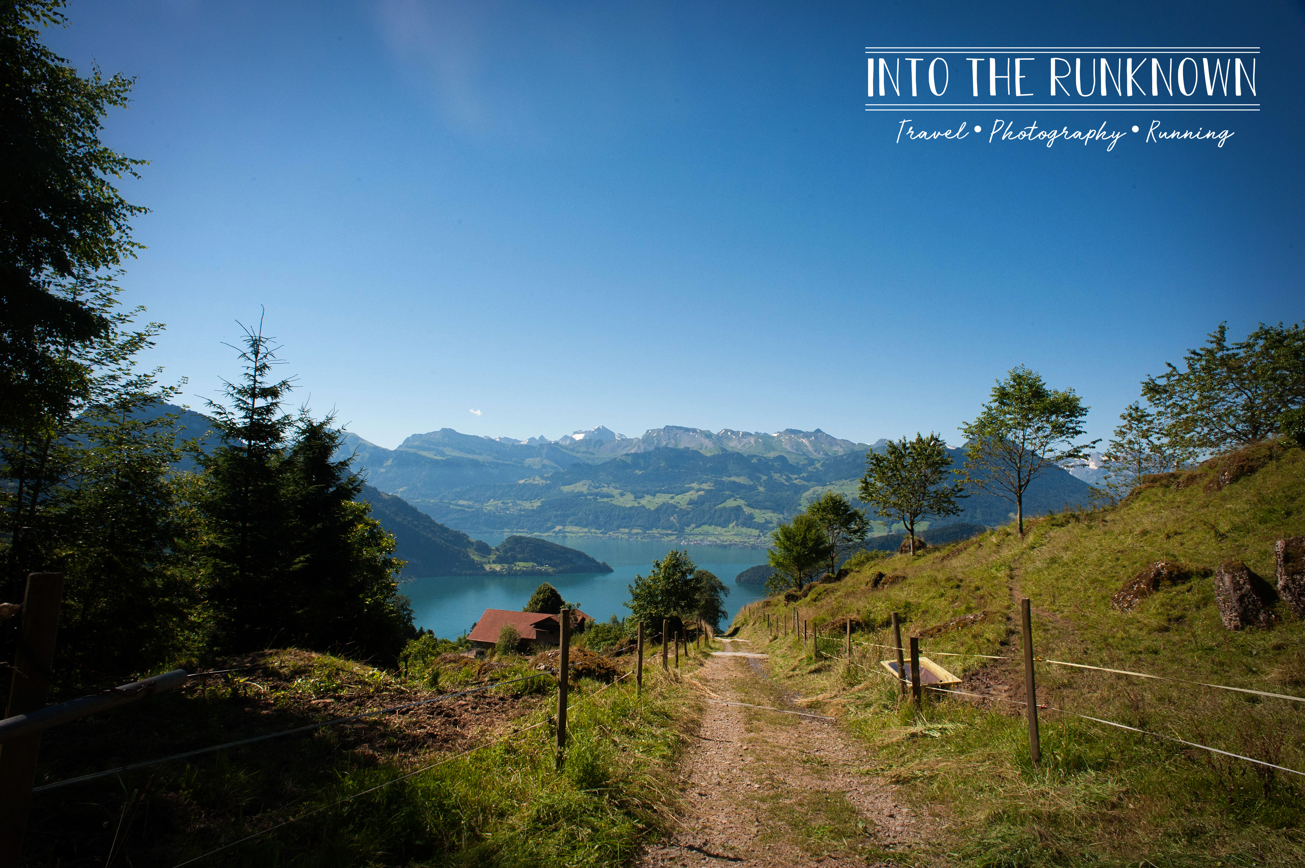
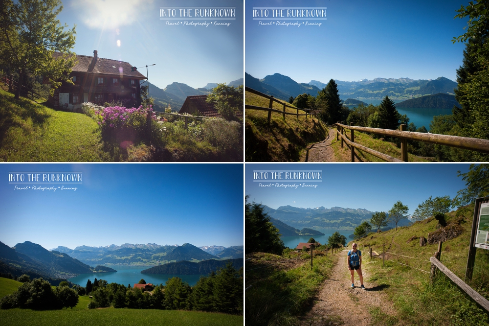
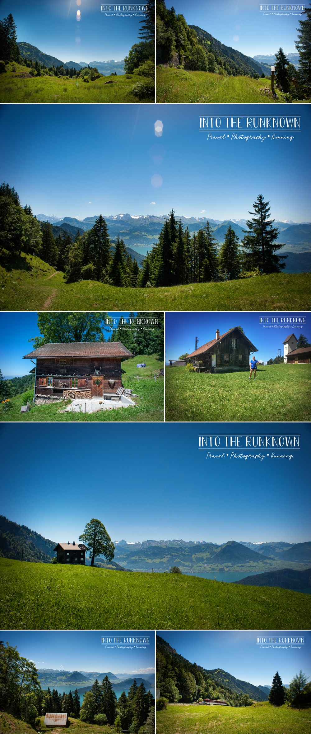
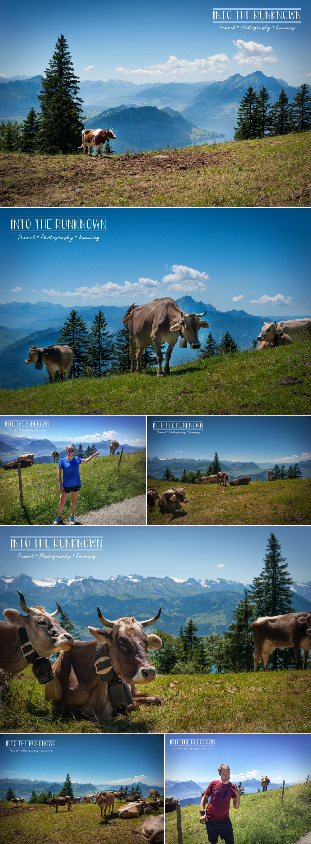
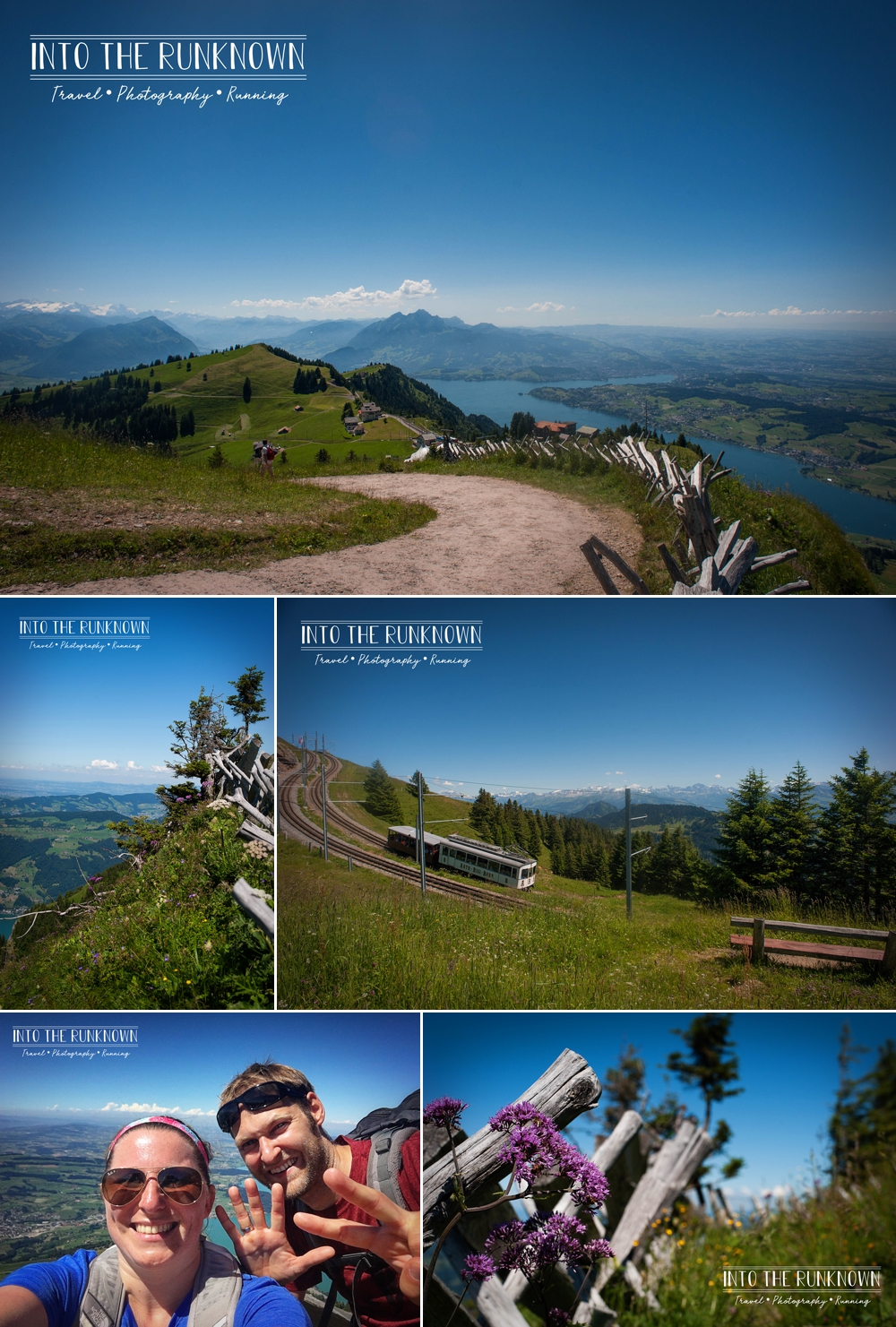
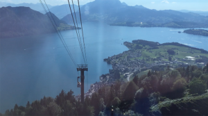
At this point the terrain changed quite a bit, and the next half-mile or so of the hike meandered through sprawling (but still uphill) wide open meadows with the occasional house or two sprinkled in. As we made our way through the open field towards the next section of trail, I glanced to the right and there sneaking up over the hill was one of the red cogwheel trains I had originally imagined myself riding to the top. It stopped at the station just in front of us and let some people off who planned to hike the remainder of the way up. I was already exhausted at this point, and wondered if they would notice if I snuck on the back and hitched a ride. But alas, we had been hiking for miles and I still hadn’t seen my cows with bells yet.
Once we crossed over the railroad tracks and made our way into the next section of trail, I got a true reality check as to how hard the rest of this hike was going to be! Little did I know, those steps earlier were a cakewalk compared to the next three miles!
In reality, the first and second half of the hike were of equal elevation increases, so they should have been of comparable difficulty. What was not equal however was the overall elevation above sea level, and it was making it physically impossible for me to walk at a normal rate of speed. The reason this was proving to be so hard for me, is that the air at high elevations such as this is much thinner and carries less oxygen, making it harder to breathe. Your body has to work much harder to do simple tasks such as walking, compared to if you were at sea level.
The area I have lived in my entire life with the exception of college, is a whopping 266 feet above sea level. Our hike started at 1666 feet above sea level and the half way mark was roughly 3,600 feet or three quarters of a mile above sea level and climbing.
For comparison, Flagstaff, Arizona where many professional runners go to train sits at 7,000 feet above sea level, which as it turns out was not much higher then the peak where our hike ended.
So here we are, in the woods approaching a mile above sea level in 95-degree heat and Sven has left me in his dust at this point. I was beyond struggling. I would take roughly five to ten steps, and would have to stop to catch my breath then would repeat the process all over again.
Sven hiked a short bit ahead to check out the terrain so he could come back and report what I had to look forward to. Suddenly I hear his voice yelling from ahead…“Hurry up! There are cows and they have bells!”Hurrying was not happening at that point, so I slowly made my way further up the trail following the clanking sounds of the bells. Finally I get to where Sven is waiting for me and what do I find? One single cow, hiding on a cliff side, behind a giant rock also trying to beat the heat. Literally all I see is the backside of said cow. You have to be kidding me! I just hiked almost four miles in 95-degree heat at elevation, to see the backside of one single cow, hiding behind a rock?? I was beyond disappointed and exhausted.
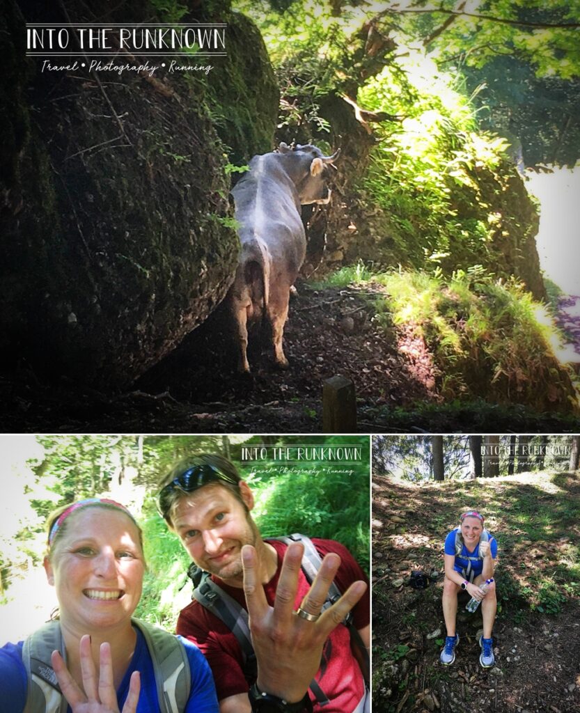
We decided to stop so I could sit down for a bit to try and regain some energy for the rest of the hike. It was at this point that I made the declaration that I was too tired to go on and now lived here. Just me, in the woods, with my one cow and its backside. Just me, in the woods with my one cow and its backside and a ton of horseflies! Horseflies that were attacking me like the borderline dead carcass that I felt like.
Energy or not, we needed to get out of this area! We weaved our way through the S gate that was setup so humans could maneuver freely between pastures but the cows could not.
So off we went again, Sven hiking ahead to check out what was next and looping back to bribe me with whatever it was to keep moving forward. He yelled back again, more cows with bells! Cool I thought, more cow backsides. You aren’t fooling me again cows, I am taking my time.
I keep moving along at my same pace of a few steps and stop, a few steps and stop, all the while looking down at the ground to make sure I don’t trip over anything. I finally look up and realize, I have exited the woods and am now standing in the middle of a large pasture…FULL OF COWS!!! Like ALL the cows with ALL of the bells clanking away! I was so incredibly happy, until I realized, I’m in a pasture FULL OF COWS, and I can barely walk, and they are really, really, big and being brown, resemble more of a bull then the dairy cows I am used to from home. I immediately froze and looked around with big eyes a bit panicked. Finally, I yelled up to Sven who was now further up the hill near the rest of the tourists, most of whom had taken the train up and were now watching and giggling amused with my predicament.
Click play below for a short video (with sound) of the field of cows I found myself standing in the middle of!
He assured me that they were not bulls and instead were nice friendly dairy cows, and I was safe to make my way up the hill to join the rest of the humans. So up I went, stopping along the way to catch my breath and made my way through the next S gate and to the safety of the path on the other side.
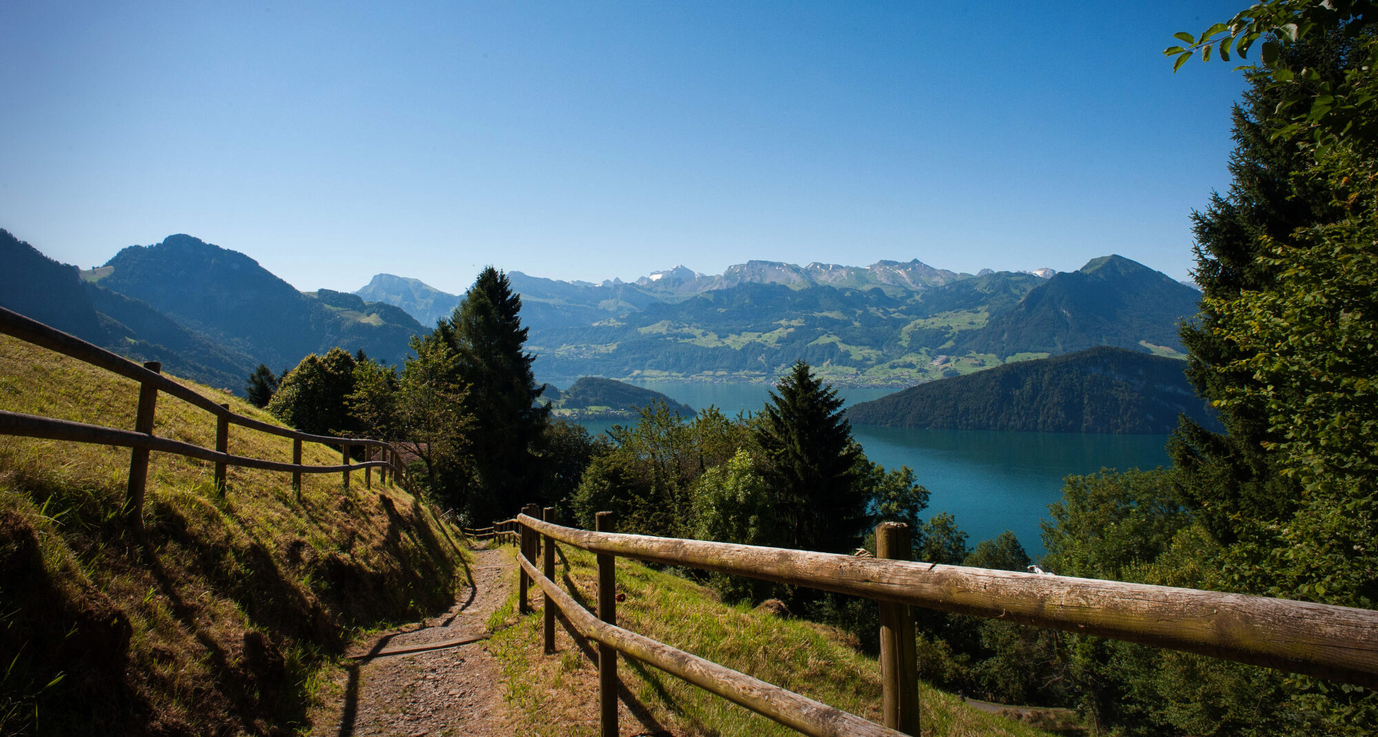
Here I found some shade to cool off in for a bit, drink some more water, catch my breath and admire both the cows and the now sweeping views of the snow covered peaks across the valley from us.
Wanting to get some closer photos of a few of the cows that were sharing my same patch of shade, I set my backpack down and reached my arms and phone through the fencing to take some photos. Thinking nothing of it I felt a little zap, checked my elbow for a bug, found nothing and went back to taking photos. After about the second or third time of this happening, I hear a woman behind me giggling. I turn around to find an adorable older woman sitting on the bench with a big smile on her face. She started speaking to me in German, which I of course didn’t understand, so she pointed at the fabric strip running horizontally along the fence. As it turns out, I had been bumping my sweaty elbows against the live electric fencing.
The consensus is that I was lucky to have been wearing rubber soled sneakers at the time, or it likely would have jolted me backwards, after all, I weight a good bit less than the cows it is meant to contain!
Click play below for a video of the glorious sounds of clanking cow bells on the side of Mt Rigi!
After hanging out here for a while and enjoying the sounds of the bells it was time to keep moving and make our way up the last two and a half miles to the peak. We walked through the area known as Rigi-First, and followed the other tourists towards the now paved path, again marked as easy and acceptable for pushing baby strollers on according to the map. Ha! Tell that to my legs and lungs!
Walking up this path was the first time since our drive in that morning that we could see the peak of Mt Rigi again, marked by a tall antenna at the top. We stopped along the way to take our mile six selfie and admire the views out over the valley, finally making our way to Rigi Staffel, the second to last stop along the way for the cogwheel trains headed to the peak.
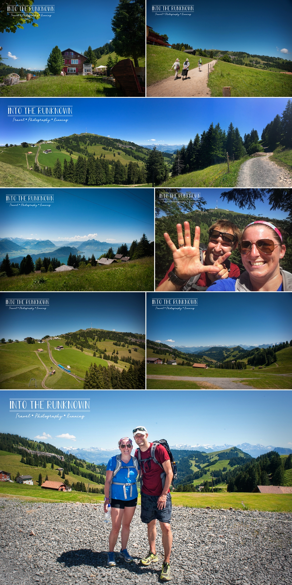
From here, on a sunny day, you can see well off into the distance in all directions. Some of the highlights from this spot are views of the Black Forrest, the Vosages Mountains, the Alps as well as Lake Lucerne and Lake Zug. We also had the pleasure of watching a couple of hang gliders floating about out over the valley. We could also see and hear off in the distance a group attempting to play an Alpine Horn. If you aren’t sure what that is, just picture a Ricola Cough Drop commercial, except we were living it in real life.
I of course stopped and posed for a photo with one of the classic bright red cogwheel trains and we had a quick chat with a family walking past asking for directions to a certain area. They took note to the fact that we were, shall we say a bit more sweaty then the other tourists up there, and we quickly had to explain much to their disbelief that we had just hiked up from the bottom.
After my many attempts at delaying the remainder of this hike, we had to keep moving, as we only had a little over one mile to go until we reached the top. This last mile was quite steep and increasingly more difficult to hike up as we were just shy of 7,000 feet above sea level at this point. Small children, families with strollers and everyone in the 80 to 90 year age category were moving faster than me up this last incline to the top. In my defense, they did have the advantage of being dropped off by the train just a half-mile below though.
We stopped for our mile seven selfie, which included views of the farms and Lake Lucerne way below and hiked the final steps up past the simple but stunning chapel Regina Montium (Queen of the Mountain) and headed for the base of the Rigi Klum hotel, which sits at the very top of Mt Rigi.
It was here that I declared I was done. I sat down on a stone wall to call it a day. Sven however kindly pointed out the sign with the little hikers behind me that stated “To the Top”. Ugh. You mean this isn’t the top already? Not being a quitter, I of course had to stand up and drag myself the additional 800 feet to the actual top, the base of the antenna tower.
The views were of course no different then they were just below at the hotel, so this was more for the satisfaction of officially hiking the entire length from bottom to top of Mt Rigi.
We decided to sit down for a bit in the grassy lawn in front of the antenna and break out the rest of the food we had remaining and rest for a while enjoying the soothing sounds of the cow bells clanking off in the distance. The next thing we know, those cowbell sounds were being replaced with the sound of a helicopter landing…right in front of us on the hillside.
As it turns out when you need to do work on the top of an antenna that sits on the top of a mountain peak, the only logical way to get tools and supplies up there is via a helicopter. My being from America and all, the land of the lawsuit happy accident lawyers, I was a bit amazed that there was no attempt to rope off this area or keep people away while this was going on. Nope, instead, people were free to roam around as they pleased, even up the ramp of the antenna tower to catch the view from those extra twenty feet of elevation, all while the blades were spinning round and round and parts were being air lifted to the top.
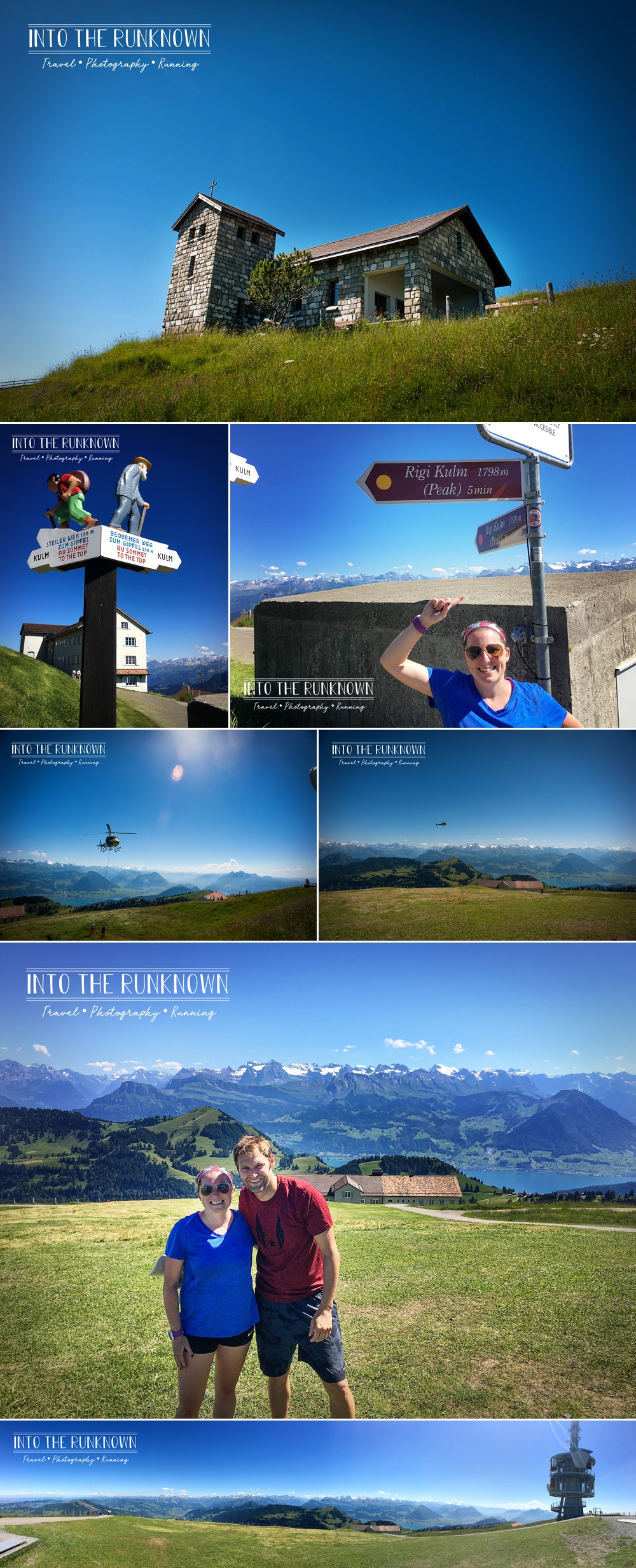
Click play below for video of the helicopter landing and a bit more of a view from the peak!
It was starting to get late, so we needed to begin the journey back down to the car, which thankfully this time was occurring via those fancy red cogwheel trains and hanging cable cars. The trains run on a very precise schedule! None of this we come as we please SEPTA nonsense we deal with here in Philly. We had some time to kill so we wandered into the hotel to make an attempt at cleaning up a bit. I went into the restroom and washed my face as best as possible with cold water and paper towels, all the while smelling like a homeless person at this point. We stopped to purchase some cold drinks and went back outside to sit on a bench overlooking the valley below and wait for the train.
The ride down was significantly quicker then the hike up. Slumped into my seat, I did my best to stay awake and enjoy the views of the ride down, but quite frankly they were a complete blur.
The train pulled into the Rigi-Kaltbad station which is about half way between the peak and the bottom of the mountain, and we all piled out following the path along to the Rigi Kaltbad Hotel. Their Mineral Bath & Spahas the most amazing outdoor bath, with sweeping views of snow-covered mountain peaks and Lake Lucerne. If you are in the area for more then a day and want to check it out, access is a very reasonable (for the area) day rate of 35.00CHF for adults and 15.00CHF for children, plus your ticket to get there on the elevated cable car or cogwheel train depending on where you are coming from. Even if you aren’t able to enjoy a swim, you can still stop at the path just above the outdoor pool and enjoy the view for free, which we did, all the while scheming how to sneak in to take a refreshing swim!
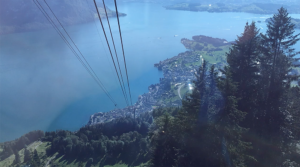
Since the cogwheel train does not go to Weggis, likely due to the steepness of the cliff just above the visitors center, you need to take the elevated cable car between Rigi-Kaltbad and Weggis. We followed the rest of the crowd from our train down the path and into an underground station of sorts. The cable car was open, so we all piled in, not knowing how many people would fit and not wanting to miss it.
Only one problem, the Swiss are very prompt people. It doesn’t matter if the car is jam packed to capacity, if the schedule says we leave at 1:00, we do not leave until 1:00 on the dot!
We all stood there, crammed shoulder to shoulder like sardines in a can for almost twenty minutes waiting for the departure time. This wouldn’t have been so bad if there was some airflow or ventilation but there was not, as the cable car station is surrounded on all sides but the front, likely to protect everyone from the elements during the cold harsh winters.
Just a reminder, two of the twenty or more people crammed in this car just hiked 7.5 miles in 95 degree heat up the side of this mountain. I have never smelled so bad in my entire life as I did at that moment. I was afraid to so much as move for fear I would send a waff of stench hurling at anyone near me.
So there I stood, motionless and quiet, while Sven called Judith his wife to let her know we survived and were on our way back down. Seeing as how both of them are German natives, this entire conversation was in German. I to this point hadn’t said a peep, so no one in the car knew I spoke English.
It was about this time, that the gentleman standing in front of us make a hilariously in appropriate joke to his wife, in English. Not even realizing it, I started smirking, which he immediately noticed and knew it was because I understood what he said. He looked over and asked if I spoke English, to which I replied, yes, I do! Based on their accents and fluent English, I already knew they were American, but was too tired to piece together that their accent was the same as my accent, as I am so used to hearing it at home I forgot that we were in the middle of the Swiss Alps.
We started chatting and he apologized (not that I was offended) saying this was a good lesson to not assume just because you are in a foreign country that no one else can understand you. I asked where they were from and they did the same song and dance I do when abroad and list the most popular sounding place that you think someone not from the area will recognize. Their response, the suburbs of Philadelphia. I just looked at them. Um, I am also from the suburbs of Philadelphia.
As it turns out, one of their daughters went to Lehigh, the other Villanova. What an insanely small world. Here we are, smashed into a cable car in the middle of the Swiss Alps and we live all of thirty minutes from each other at home. They gave us the run down on what sounded like an amazing tour of Europe they were in the middle of, which of course led to the question of what we were doing there, and the extra confusion on my being from Philly and his being from Germany and how we met.
We explained (and apologized for our stench) that we had just hiked up from the bottom and were on our way back down to tour Lucerne for a short bit, before heading back to the hotel and that we met when he was an exchange student at the same college. They invited us to join them for a meal however with Lucerne being one of the most expensive cities in Switzerland, we didn’t feel comfortable strolling in to any of the restaurants as nasty as we were, so we politely declined.
Finally after what seemed like an eternity, the clock hit the scheduled time, the doors closed and we floated off out of the station heading down towards the bottom. I had intentionally made my way to the front window immediately upon entering the car so I could get a front row seat of the views on the ride down. Due to the way you float on the cables, the ride was actually quite fun! At various points along the way, you approach tall towers that the cables attach to and the car switches from one set of cables to the other lifting you up a few feet then dropping you down onto the line below. Everyone got the hang of this quickly and would oooh and ahhh each time in unison.
Click the below images for videos of the cable car ride down from Rigi Kaltbad to Weggis!
Once back on the ground, we hopped in the car and took the short drive to a parking garage in the center of Lucerne. There we did our best to change into dry, fresh smelling clothes before wandering around the city a bit. I can assure you, while they were a lot more comfortable, they did nothing to mask the smell.
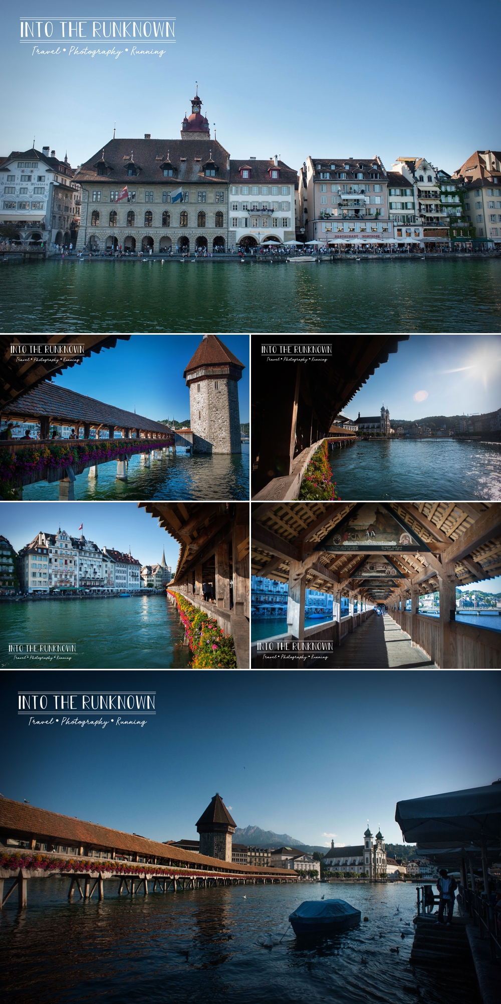
First we headed over to Chapel Bridge, which is a long wooden covered bridge that crosses over the lake from one section of the city to another. It was built in 1333 (yes, you read that correctly) and is very ornately decorated inside by hundreds of small paintings, which were added around the 17thCentury.
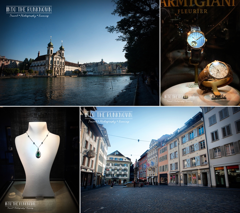
Not being able to comfortably go in any shops, we walked a short loop along the lake and down a street a block back with a number of very ornately decorated buildings, stopping at one of many high end jewelry stores to of course only window shop. Aside from being gross, the items in the front window cost only a few thousand dollars less then my house, so they were staying put in Lucerne. We ended up running into our friends from the cable car again who tried to talk us into a drink but we again declined opting to head back to the hotel to shower, eat some dinner and the attached restaurant and go back to the room to pass out.
We had one final full day left in Switzerland, which was going to involve another early start and with much excitement watching the start of stage 17 of the 2016 Tour de France in Bern!!
Mt Rigi Fun Facts and Helpful Info:
How it got its name and nickname: Rigi comes from Swiss Old High German and refers to horizontal strips or bands, which is what the rock formations resemble. Queen of the Mountains was coined by Albrecht von Bonstetten, who was a Swiss Humanist (someone who studies Classical Antiquity…aka the time period around 8th-7thCentury BC, long before the Parthenon was built and looooong before gladiators were fighting in the Colosseum). Long story short, he interpreted Rigi to mean Regina Montium or Queen of the Mountains and the name stuck!
Location:In the cantons of Schwyz and Lucerne, Switzerland. There are many locations that you can hike or take the cable car or cogwheel train from, but we started at the Gondola Station in Weggis, Switzerland (Rigistrasse 73, 6353 Weggis, Switzerland) not far from the city of Lucerne.
Elevation at Rigi Klum (the peak): 5,897 feet above sea level or 1,797.5 meters for you metric folks.
What can you see from the top?: On a clear day, there is a 95 mile visibility from the peak which includes views of Lake Lucerne, Lake Zug, Lake Lauerz the Black Forest as well as a variety of other nearby mountain peaks.
Ways to the top:
Rack Railway/Cogwheel Train – Trains traveling up steep grades use a toothed rack rail system that runs down the center of the metal tracks for the wheels and provides more friction then just the train wheels alone.
Gondola Lift – An Ariel car that is supported and propelled by steel cables above. The cables are strung between two stations and occasionally have supporting towers in the middle if the distance is particularly long. The cables run continuously in a loop, so when other lifts behind or ahead of you cross over the support towers, you can feel the movement in your own car despite you being in between towers. This is what we rode in to get back down the bottom half of the mountain.
Cable Car – This is also an ariel lift but works of a lift system much like you would ride at a ski resort, but passengers safely ride in an enclosed car similar to the gondola mentioned above. This is very similar to the Godola Lift mentioned above but works off a two cable system, one for each direction, instead of a continuous moving cable.
On Foot – If you are adventurous like us, you can hike all or part of the way to the top.
Why are all those cows up there any way?:
As it turns out, those cows are visiting Mt Rigi on vacation just like you and I! Farmers move what is considered non-essential dairy cattle to various mountain sides in the summer to give them a break from working. They are able to lounge around all day eating grass then are brought back down to the flat lands come fall in a spectacular fashion to work as dairy cows again in the warm barns through winter.
Cows are decorated with very ornate floral head wreaths and their bells are switched out for much, much larger bells that are also sometimes decorated and they are paraded through town back to the farms, much to the delight of the local residents.
What do you need to bring to hike?:
I would recommend at the very least comfortable sneakers, though hiking boots if you own them would be appropriate as well, especially if you have weak ankles. Assuming you are hiking in the warm months, you will want to wear comfortable sweat wicking clothing. Sun screen is a must, and bug spray is not a bad idea either, as you are hiking through open fields and forests! You should also take a hat and sun glasses to protect your face and eyes. Definitively bring ample water. We carried two large bottles each, refilled at a spring along the way and still had to buy more at the top. Also carry some food such as a sandwich or other easily transportable meal for each person hiking, even if you are only doing half the hike. A working cell phone and maybe some minor first aid items such as band-aids are not a bad idea either. The trails are fairly-well marked and other then steepness and elevation, they are what I would consider a low level of difficulty as far as footing goes. It is still a mountain though, you can very easily get off track and end up lost in a more remote area then expected. Better to be prepared then find yourself stranded. And I would be remiss if I didn’t remind you to bring a camera! After all, did it really happen if there is no photographic proof?
A Map of the mountain and various trails, trains and attractions can be found here:
Official Website, Ticket Pricing & Time Tables: